Can I draw a circular zone?
Yes. Site Concept includes a circle zone option in addition to freeform zone drawing.
Site Concept is a visual planning studio for turning program and spatial intent into editable zones, paths and organic Soft Islands. Draw directly over a site, organise functions, refine relationships and keep control of every shape.
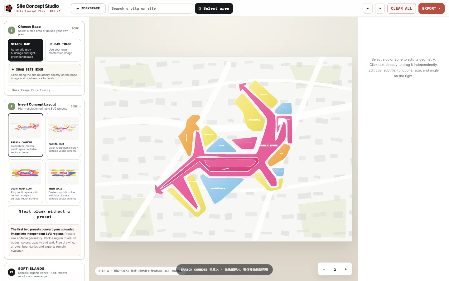
Draw polygonal zones or clean circles, then move, resize, recolour and label them.
Create smooth organic program clusters that can be added, deleted and recoloured independently.
Global visual presets can change the overall finish without erasing colours you deliberately assigned to individual zones.
Draw the functional areas and key spaces directly on the canvas.
Add paths, arrows, labels and organic Soft Islands to express the spatial idea.
Use a preset for line, material and atmosphere while keeping custom zone colours intact.
Search the map or upload your own image, draw the site edge, then fade the base, buildings, roads and green separately so the concept stays on top.
Main zones and sub-zones with primary and secondary titles and small programmes. Block, strip, wedge and plaza shapes, with opacity, roundness and outline.
Main spines, secondary links and local links as smooth curves or straight segments, with arrow heads and labels.
Organic programme clusters you can add, recolour and delete one by one.
Snap zones to the roads, clip them to the site boundary, fade everything outside it, and show a legend and north arrow.
PNG at 2× or 3×, and SVG for Illustrator. Site Concept is part of Max.
For solved zoning with exact areas on the same plot, see the Parametric Lab.
Yes. Site Concept includes a circle zone option in addition to freeform zone drawing.
Yes. They can be added, selected, deleted, recoloured and adjusted after generation.
Custom colours are preserved so a visual preset does not flatten every zone into one colour.
Yes. Site Concept supports editable vector-oriented export workflows alongside raster output.